Marking time in February 2016
Putting “Swim for the reef” on the map
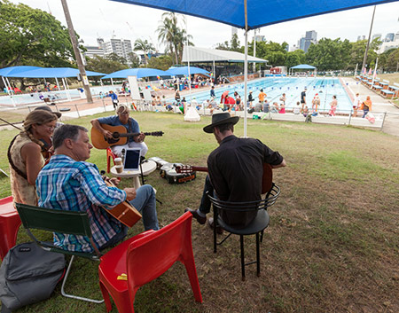
The Queensland Environmental Defenders Office should be pleased with its Swim for the Reef fundraiser on 23 January 2016. Teams of swimmers clocked up 5,700 laps (285 km)—that’s about a tenth of the length of the Great Barrier Reef itself.
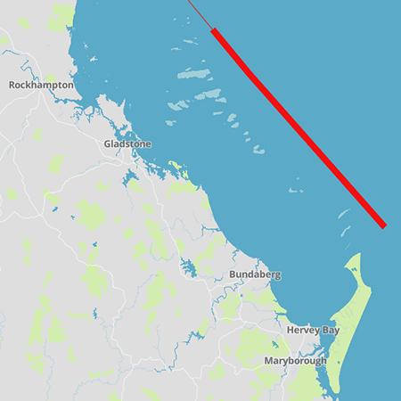
A couple of weeks before the event my friend Jo Bragg, CEO of EDO Qld, asked if I could produce a graphic to plot the progress of the swim. We agreed a map of the Great Barrier Reef, marked with a line to represent the distance swum, would be a tangible expression of the abstract idea of swimming for the reef. I said “yes, I can do that” and “give me a day or two to work out how”.
Instead of having a paper map displayed in one place, I thought it should be published on the web and regularly updated during the event (to support the social media campaign). I wanted to show the islands and reefs in detail (to reinforce that the Great Barrier Reef is a real place). And I wanted the path of the swim to follow the typical track taken by ships as they weave through the hazards.
I discussed the project with Thom Blake who has done more online mapping than I have. I followed his suggestion to use MapBox to create and update the map. MapBox Studio did the job, and it was free, though I found it confusing and poorly documented.
The base layers came from the wonderful OpenStreetMap, which I think of as the wikipedia of online maps. Unfortunately, underwater reefs have not yet been included in OpenStreetMap.
Fortunately the GBRMPA (Great Barrier Reef Marine Park Authority) website provided a kml data file which I used to show all the reefs on the map.
I decided to show the accumulated distance swum by the participants, laid out along a route that a ship might take from the southern boundary of the Great Barrier Reef World Heritage Area (just north of Fraser Island) to the northern limit of the area in the Torres Strait. I used a GBRMPA map of designated shipping areas to plot a course as far as Cairns. For the tightly regulated route north of Cairns I used the exact route specified by AMSA (the Australian Maritime Safety Authority). The whole route is drawn on the map as a thin red line. Then, as I received reports from the EDO people who were keeping count of the laps, I added a thicker red line to show progress.
The event has its own Facebook page, though I paid more attention to what was happening on Twitter.
I expect that next year the event will make an even bigger splash (and raise even more money to support the EDO). I’ll try to make the map better too—there is room for improvement.